
|
| Length |
Difficulty |
Streams |
Views |
Solitude |
Camping |
| 3.7
mls |
 |
 |
 |
 |
N/A |
Hiking
Time:
Elev. Gain:
Links:
Resources: |
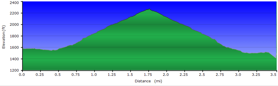
2.5 hours with 1/2 hour of breaks
800 ft
 Monongahela National Forest
Topo Hike Trails Map (PDF)
Seneca Rocks Weather Forecast
Garmin (GDB), Gaia/Trails App (GPX) (What's
this?)
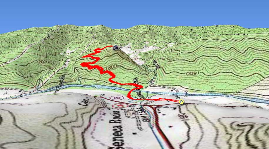
3D View of Route |
 By Trail Contributor: Jeff Monroe (Email Jeff) By Trail Contributor: Jeff Monroe (Email Jeff)
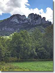
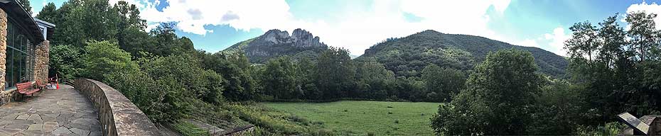
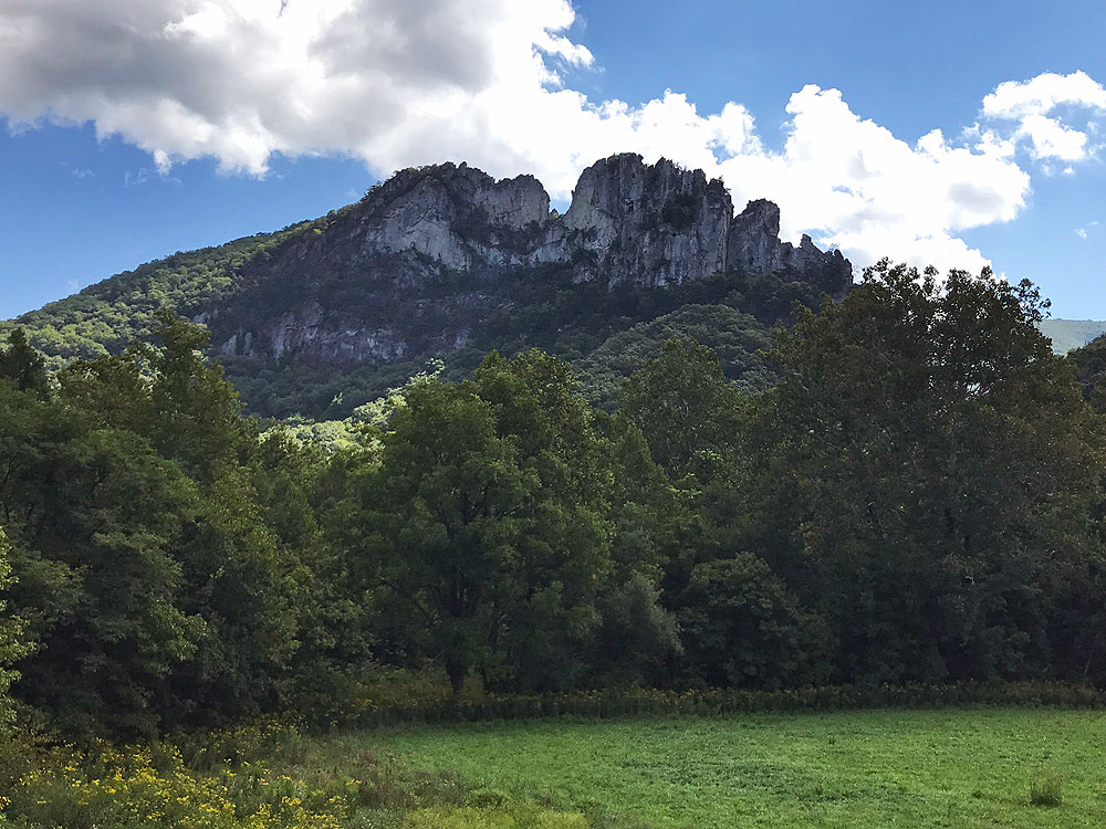
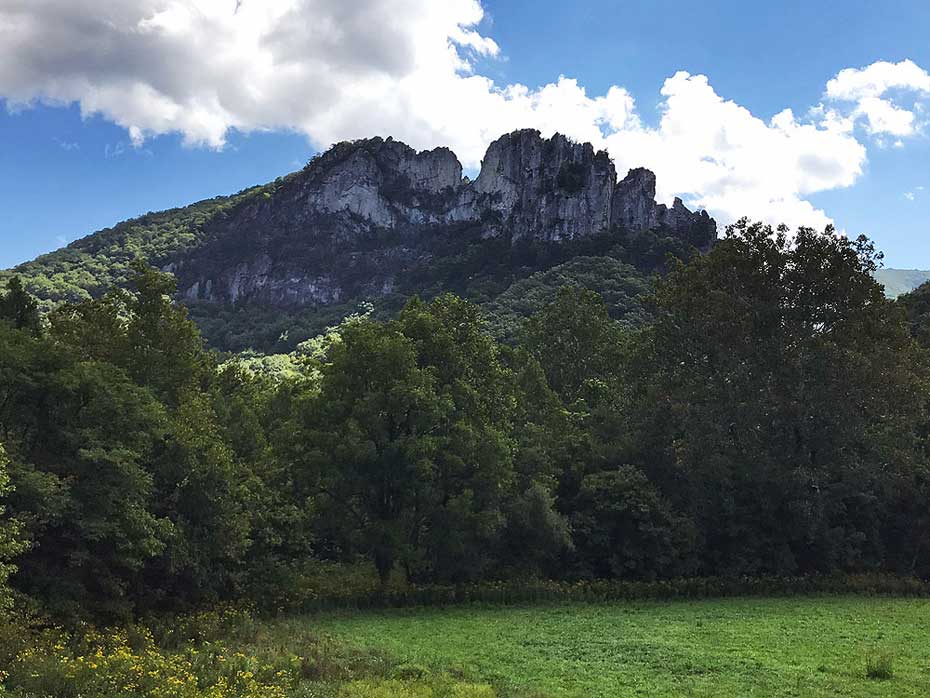
Seneca Rocks is perhaps the most well known of all natural landmarks in the Mountain State. As a result this hike, which climbs to an observation deck next to the rocks, is a very popular one for hikers of all levels of experience. It provides a good workout, climbing at a 10% grade all the way to the outlook – but it is short and the view is worth the effort.
This hike is most like Mary’s Rock in Shenandoah National Park and Humpback Rocks on the Blue Ridge Parkway: a popular trail featuring a short, sometimes steep climb to a spectacular vista.
-
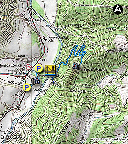
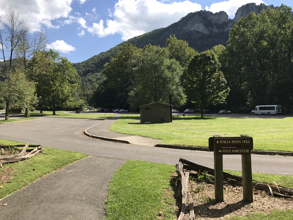
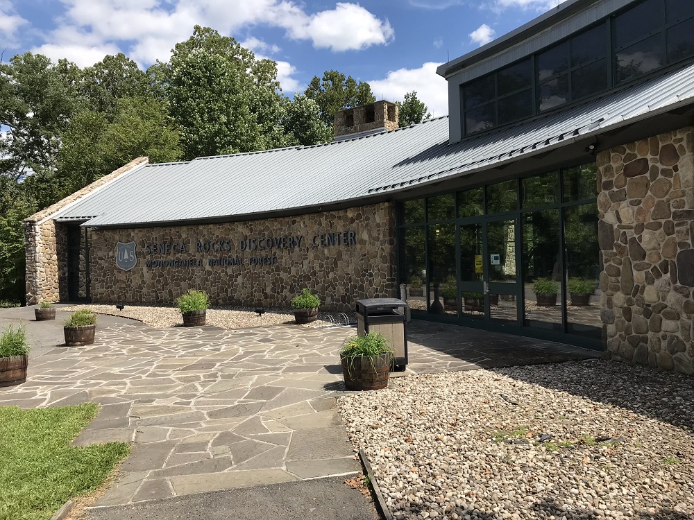
Mile 0.0 – Park at the Seneca Rocks Discovery Center parking lot off of U.S. 33. There is another, larger parking lot further north on WV 28, but parking here takes you through the Discovery Center, with exhibits and a store.
-
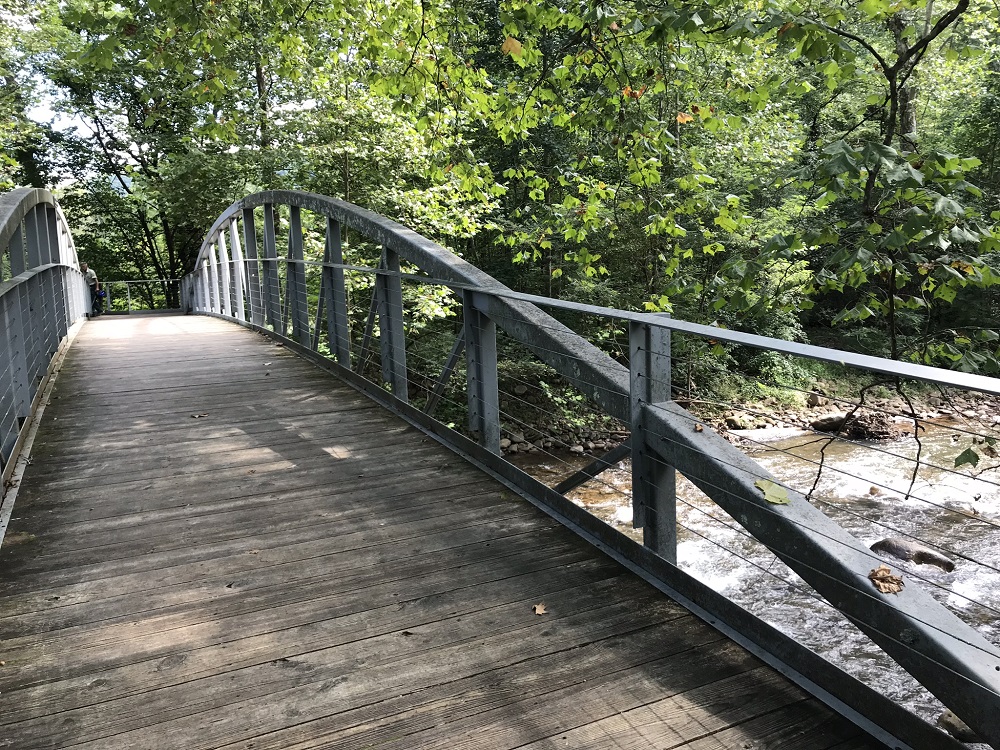
Mile 0.2 – Walk through the Discovery Center to a vista on the other side. You can pick up a trail map here. Walk down the steps to the trail and take a left, following the sign towards Sites Homestead. Take a boardwalk then bridge over Seneca Creek.
-
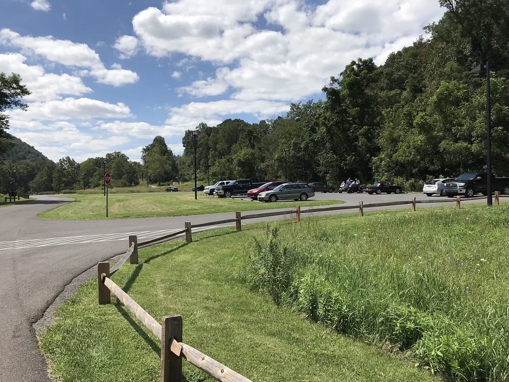
Mile 0.3 – You will come out into another parking lot with picnic tables and pit toilets. This lot is larger than the first one, and can be used if the first one is full. This area was the site of the original Seneca Rocks Visitor Center, destroyed by arson in 1992. Follow the paved path through the lot.
-
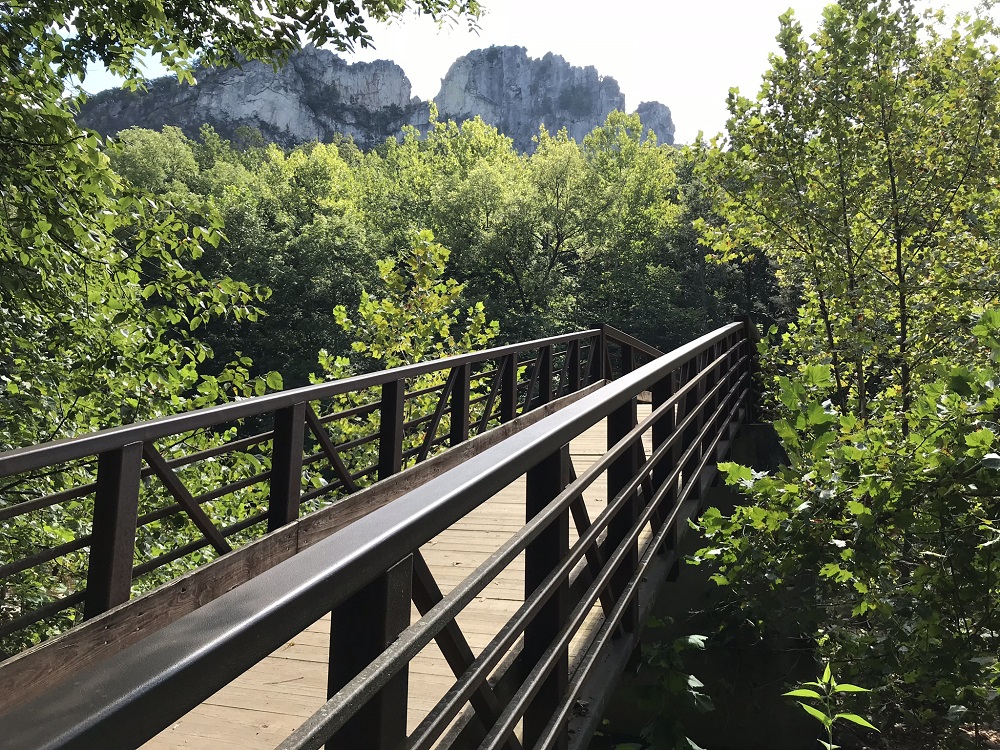
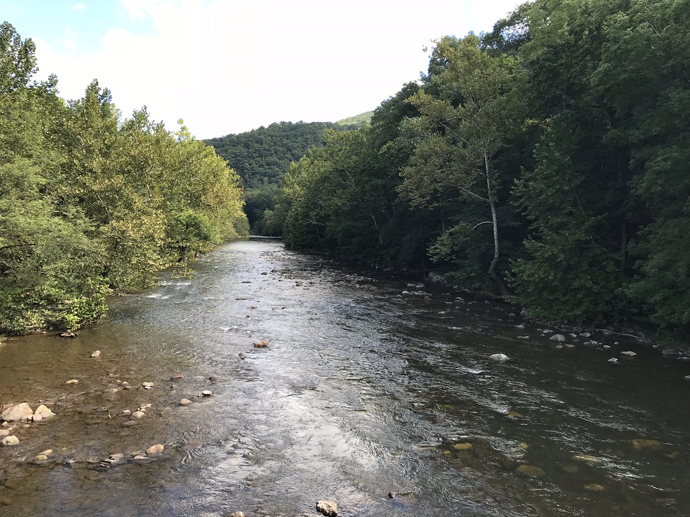
Mile 0.3 – Enter the woods next to an information kiosk and cross a larger bridge, this time over a fork of the Potomac River.
-
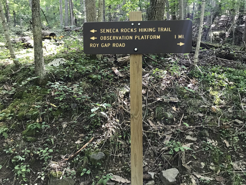
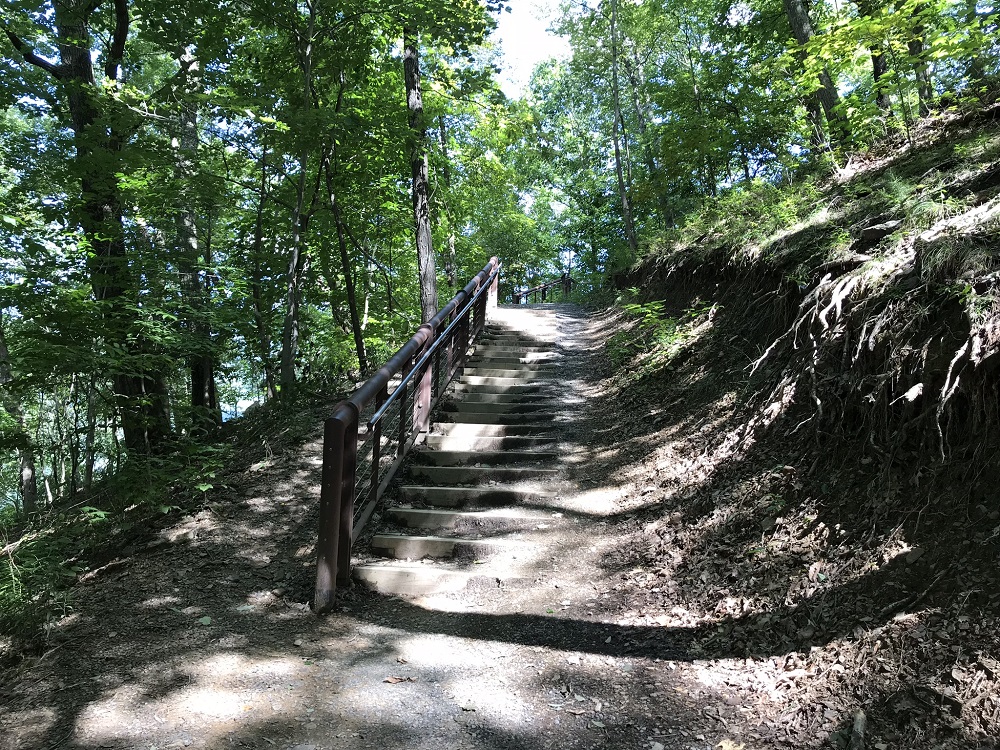
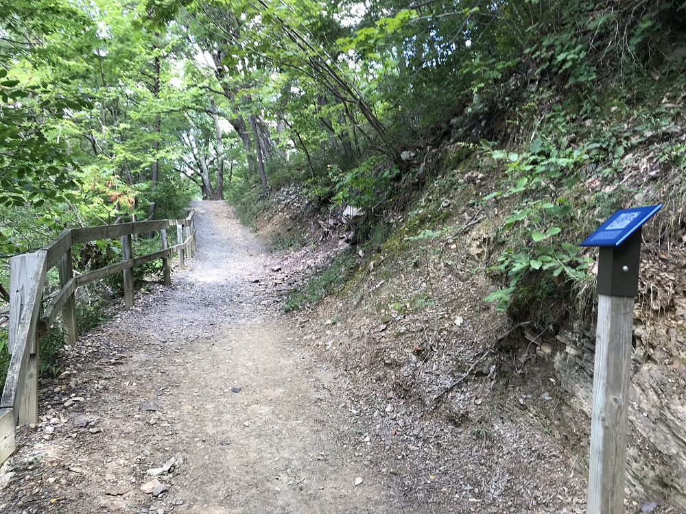
Mile 0.5 – Come to a T intersection, marked by a sign. Follow the path to the left. The trail is wide and maintained for heavy use, with occasional steps, switchbacks, and informational sign posts.
-
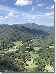
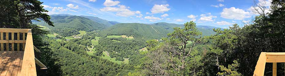
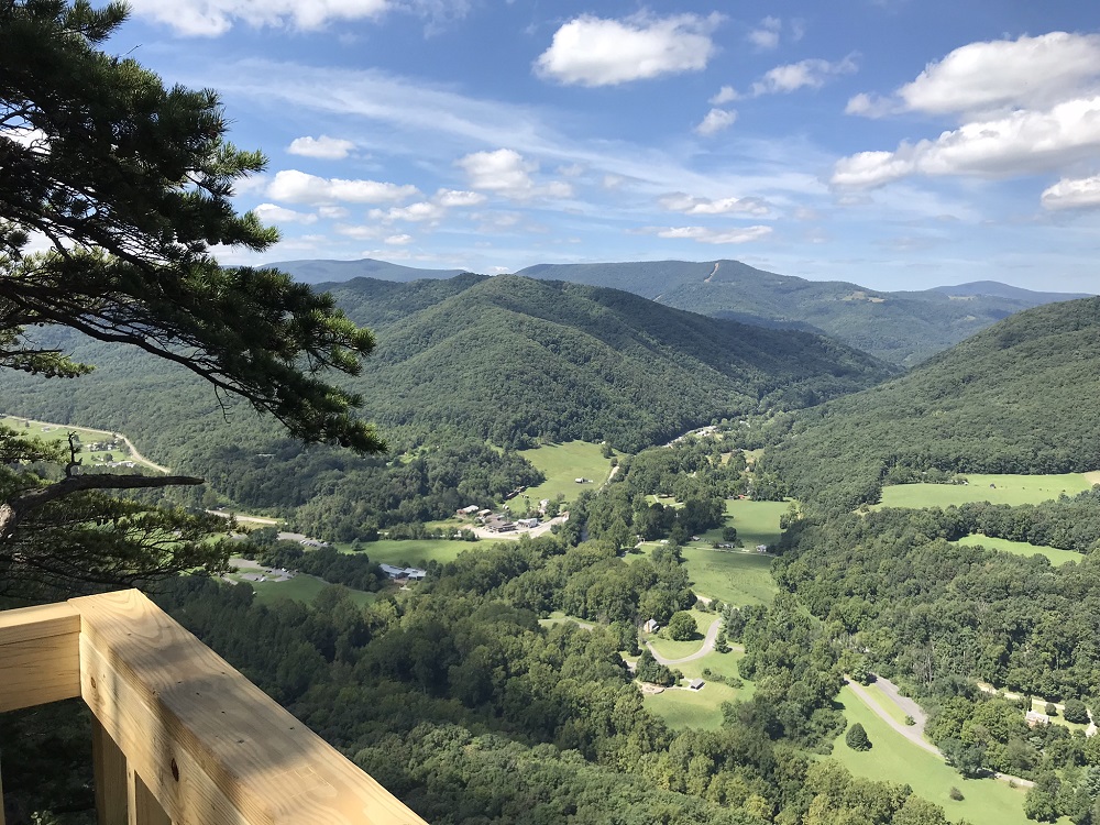
Mile 1.7 – The trail reaches a wooden observation deck with spectacular views of the Potomac and Seneca valleys, along with multiple 4000+ foot mountains. Turn around here.
-
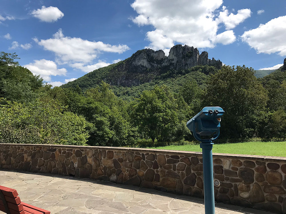
Mile 3.5 – Follow your steps back to the Discovery Center, where you might use one of the coin operated binoculars to look for rock climbers on the rocks, or simply sit and soak in the views. Sharp eyes will be able to pick out the platform you reached, to the left of the rocks.
-
Mile 3.7 – Return to your vehicle in the Discovery Center parking lot.
|
