
|
| Length |
Difficulty |
Streams |
Views |
Solitude |
Camping |
| 10.7 mls |
 |
N/A |
 |
|
N/A |
Hiking
Time:
Elev. Gain:
Resources: |
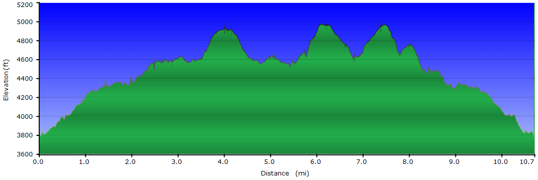
5 hours and 30 minutes with 1 hour and 30 minutes of breaks
2,045 ft
 Pond Mountain Game Land Pond Mountain Game Land
Topo Hike Trails Map (PDF)
Nella, NC Weather Forecast
Garmin (GDB), Gaia/Trails App (GPX) (What's
this?)
3D View of Route |
 By Trail Contributor: Zach Robbins (Contact Zach) By Trail Contributor: Zach Robbins (Contact Zach)
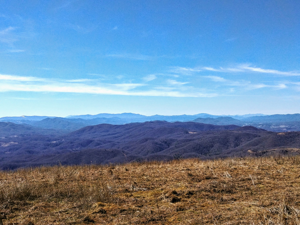
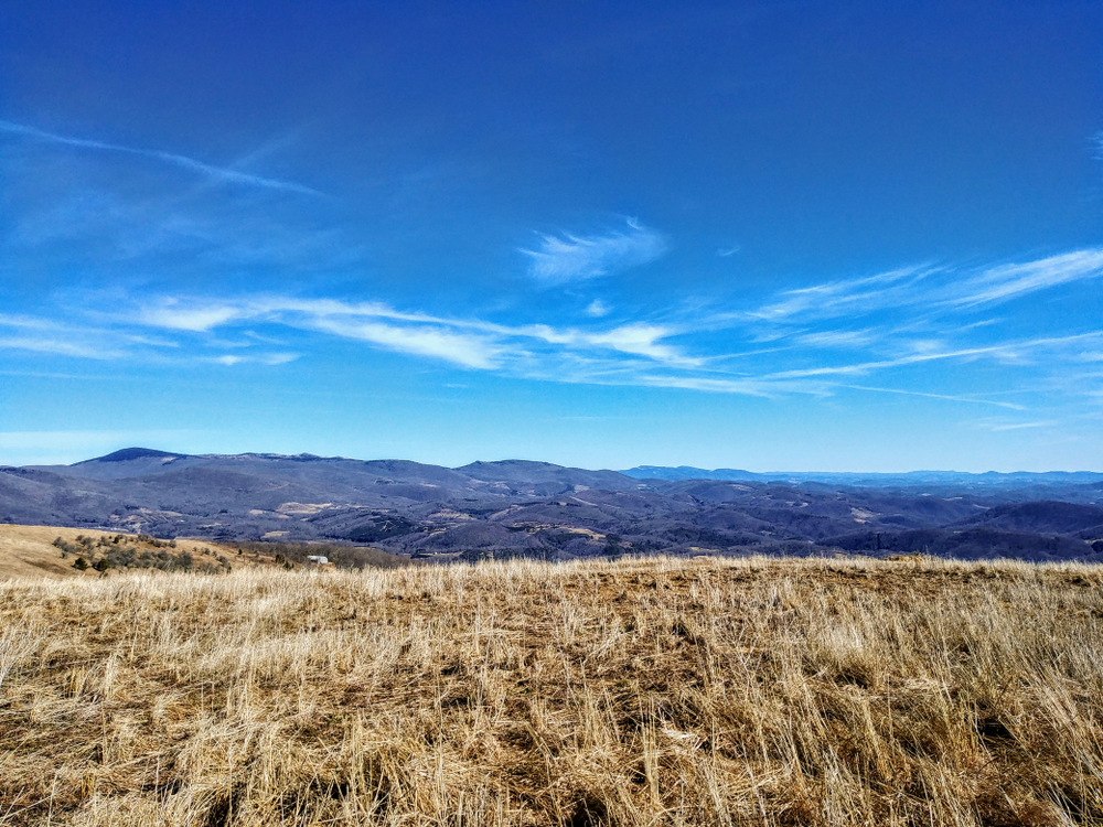
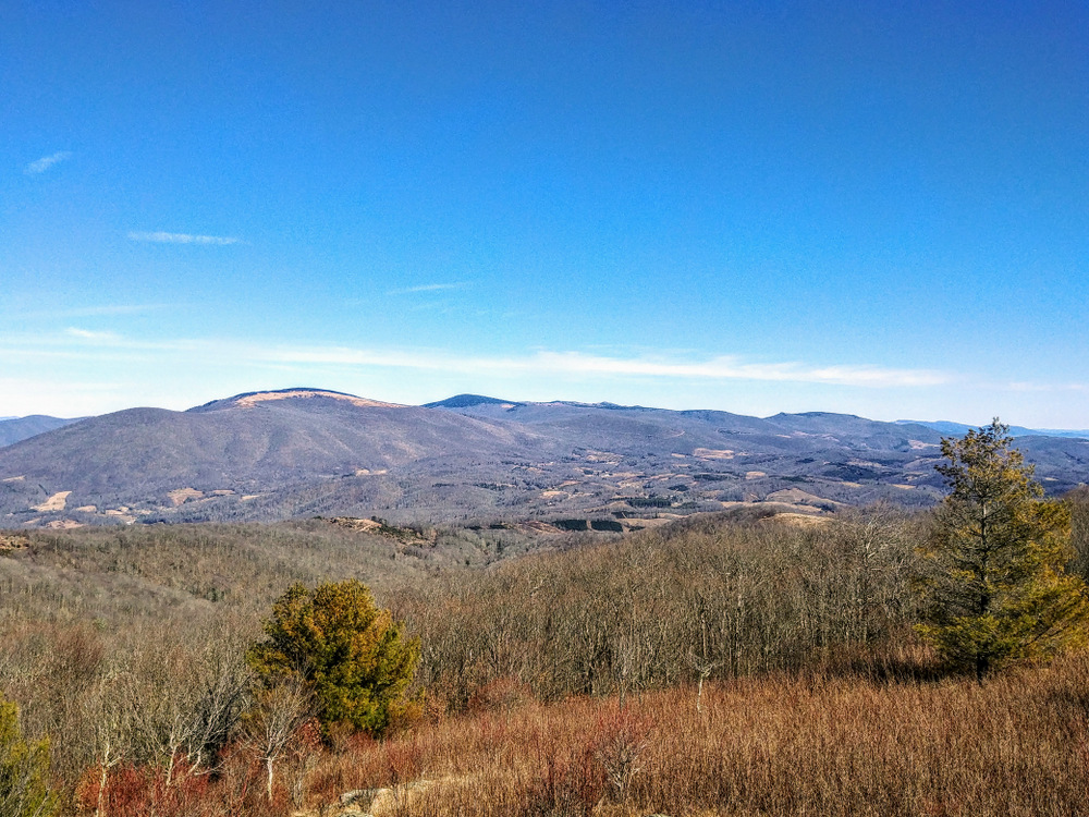
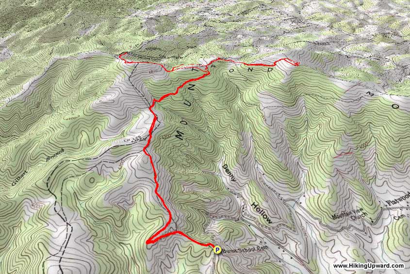
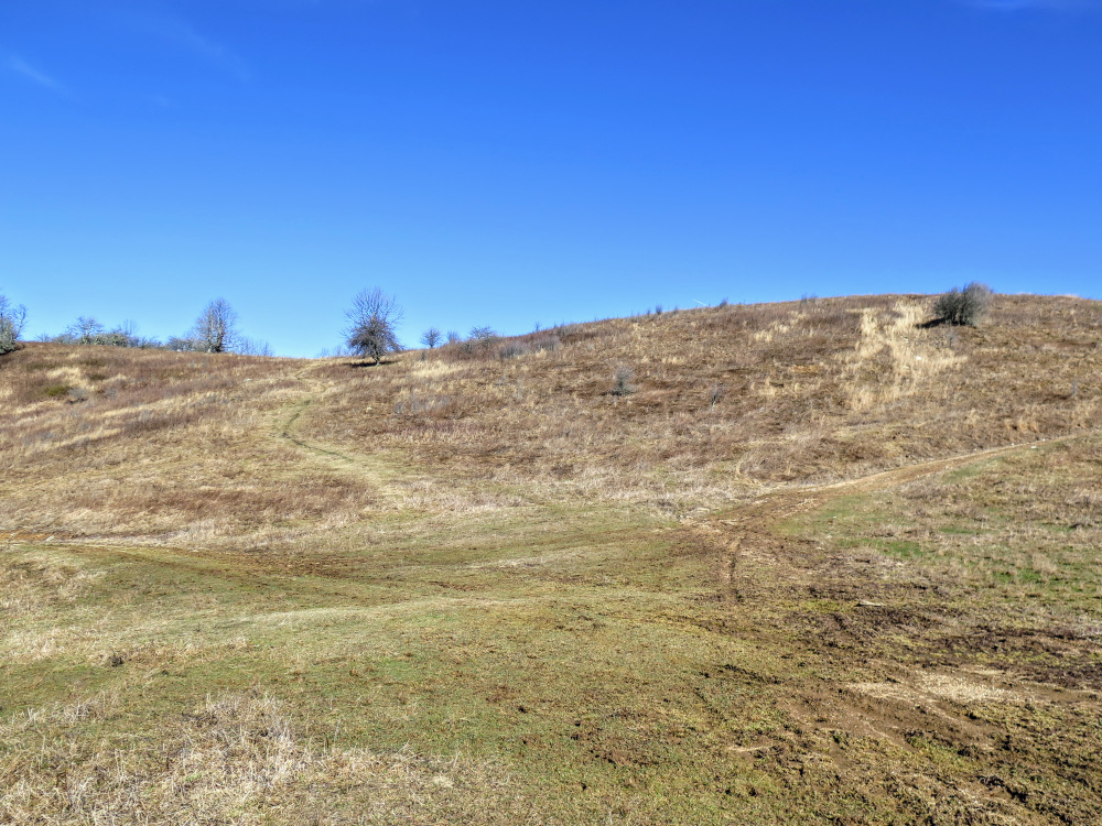
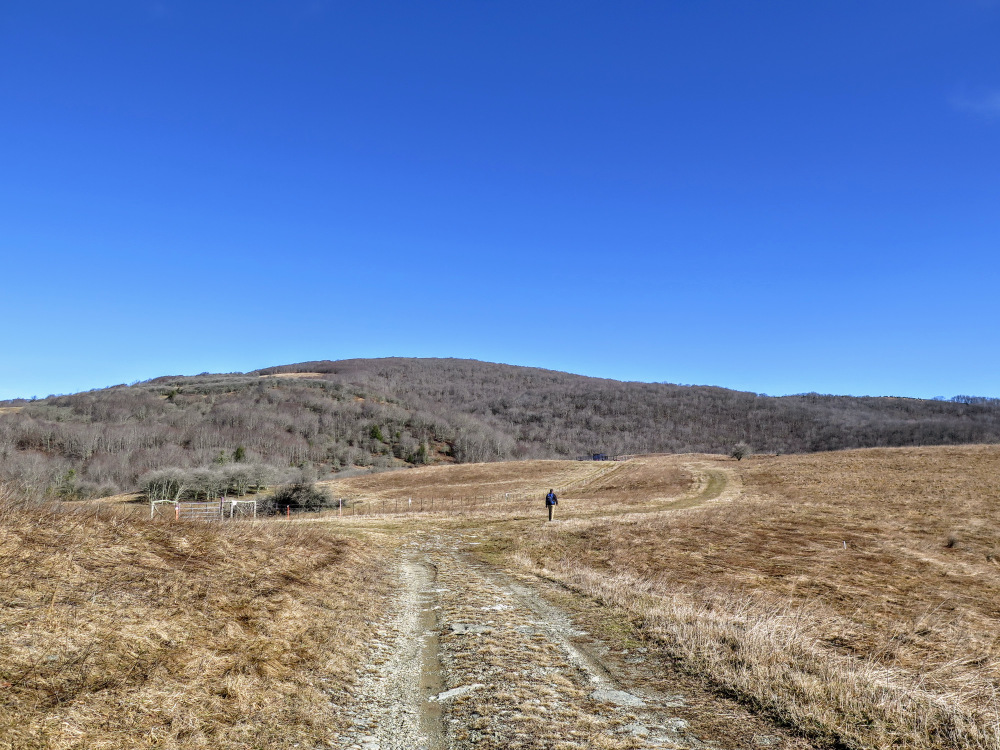
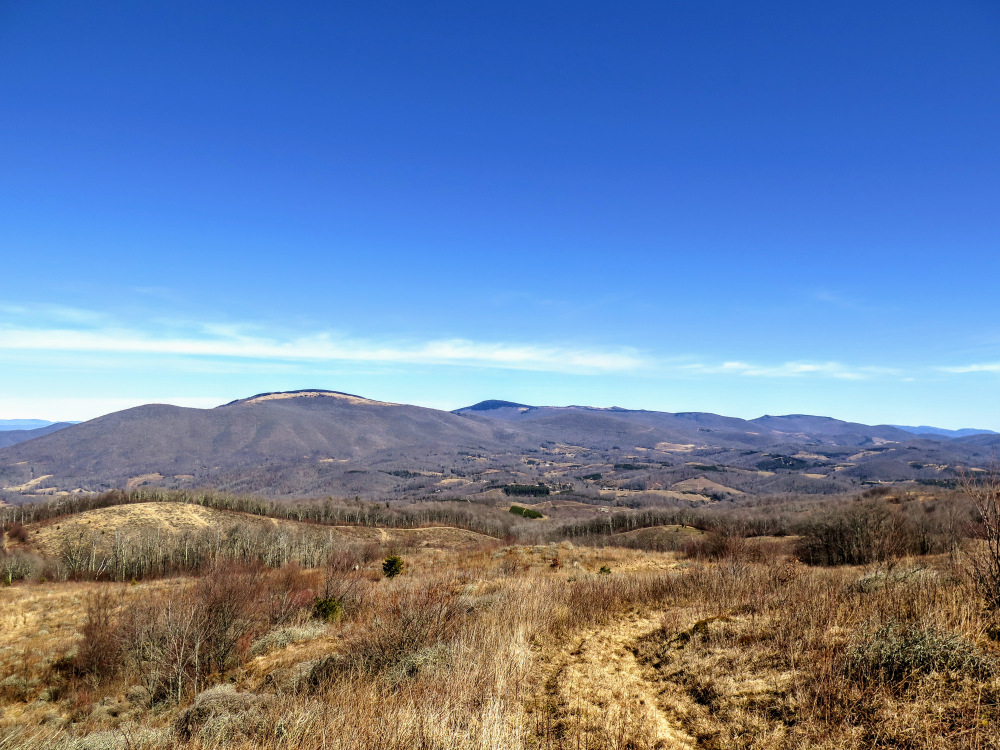
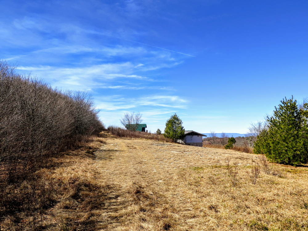
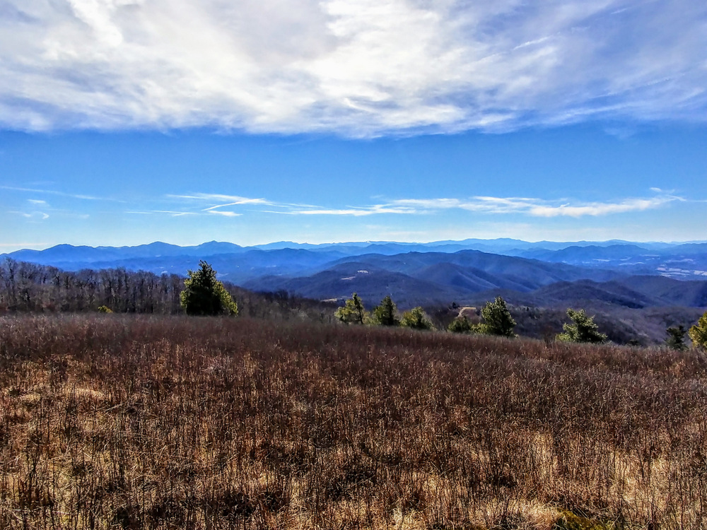
Typically a mention of the Iron Mountains brings to mind the windswept rocky plateaus of the Grayson Highlands and the two highest peaks in Virginia, Mount Rogers and Whitetop Mountain. However, the mountain range extends southwest from these popular hiking destinations into the isolated tri-state corner of North Carolina, Tennessee, and Virginia. Public access in this region is sporadic to say the least. The Tennessee side has a few official horse trails within Cherokee National Forest, while the North Carolina and Virginia side is a mishmash of game land and private property. In 2010, the Blue Ridge Conservancy aided the transfer of nearly 1,800 acres around Pond Mountain to the N.C. Wildlife Resources Commission. Now the Pond Mountain Game Land is publicly accessible and the outstanding views from the peaks can be experienced by all. The majority of this hike passes through grazing land and old Christmas tree farms. Since the surrounding land has been cleared, you’ll have superb views with almost every step. The summits of Pond Mountain and Stone Mountain and additional viewpoints provide the finest views of the Iron and Amphibolite mountain ranges in the region.
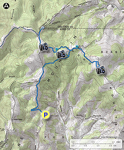
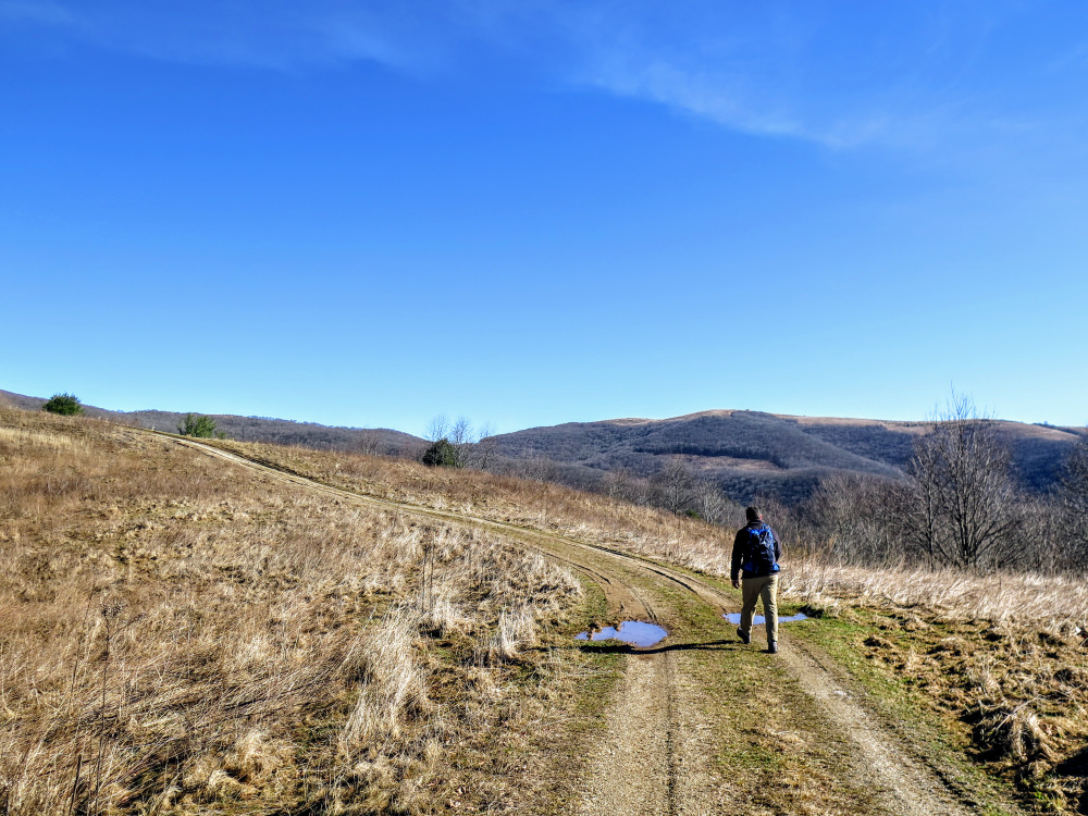
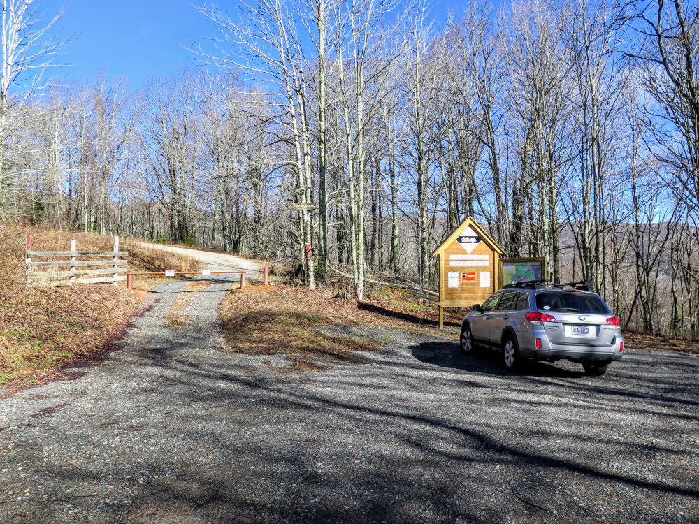
There are two main access points to the game land, this hike begins at the Burnt School Cemetery entrance which lies centrally between Pond Mountain and Stone Mountain. This is the best access during the winter. The primary entrance forest road, located off of Rock Fence Rd, takes you almost all of the way to the summit of Pond Mountain. However, there are two gates along the entrance road that are seasonally closed, which would make the round trip much longer. We suggest using this entrance from April 1 – January 1.
| Mile Summary and Highlights |
0.0 - Follow open forest road into Pond Mountain Game Land
2.7 - Trail split for Pond Mountain and Stone Mountain
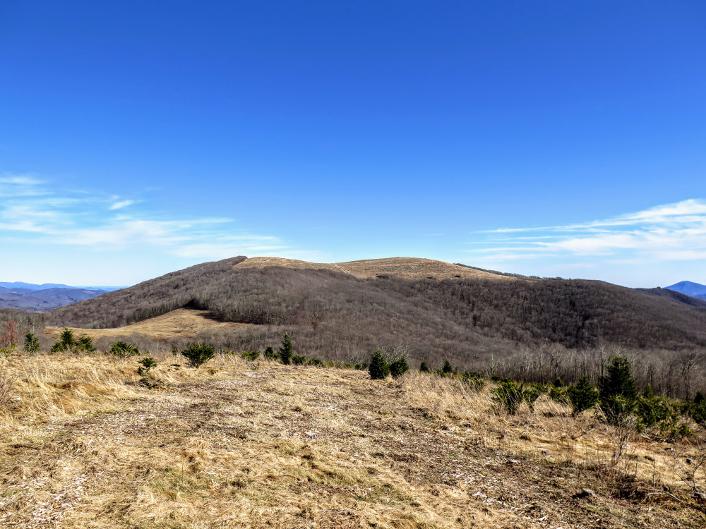
4.0 - Pond Mountain summit (4,960 feet) and 360° views
5.7 - Forested summit trail to Stone Mountain
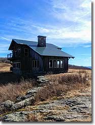
6.1 - Stone Mountain summit (4,980 feet) beside abandoned cabin
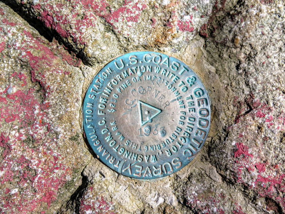
6.8 - Tri-state corner of North Carolina, Tennessee, and Virginia (4,628 feet)
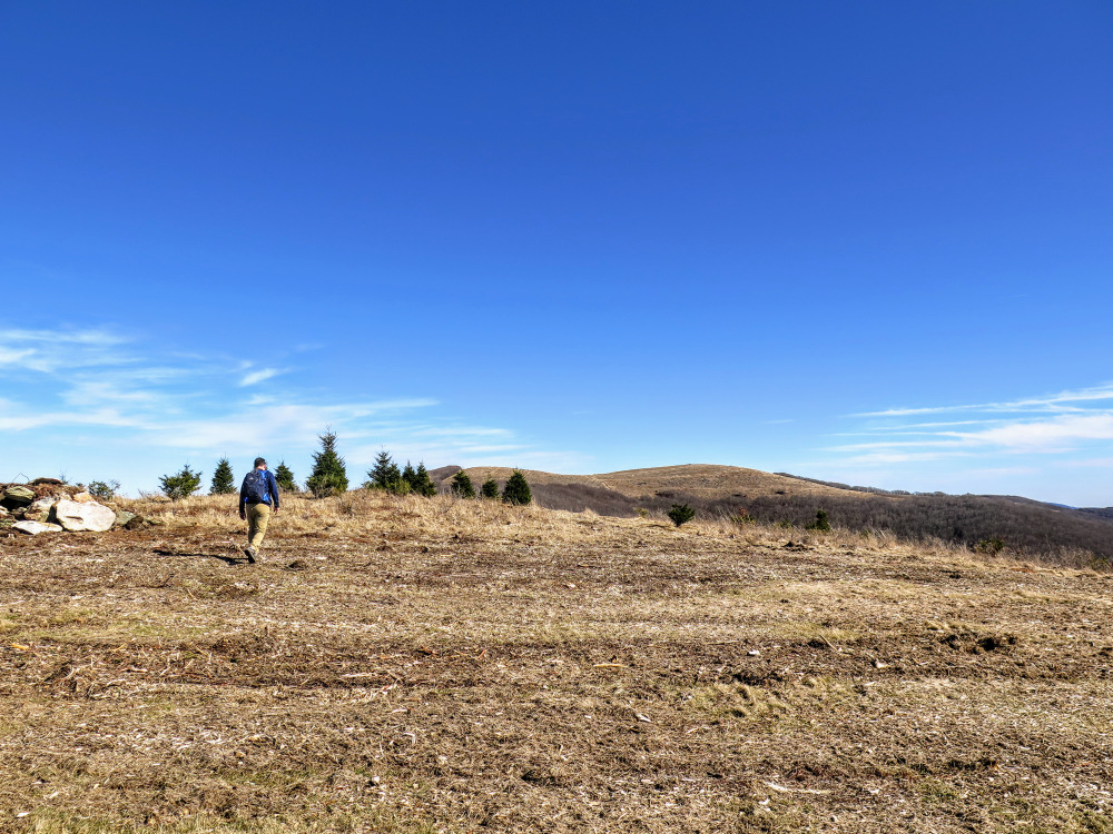
8.0 - High point of old Christmas tree farm with panoramic views |
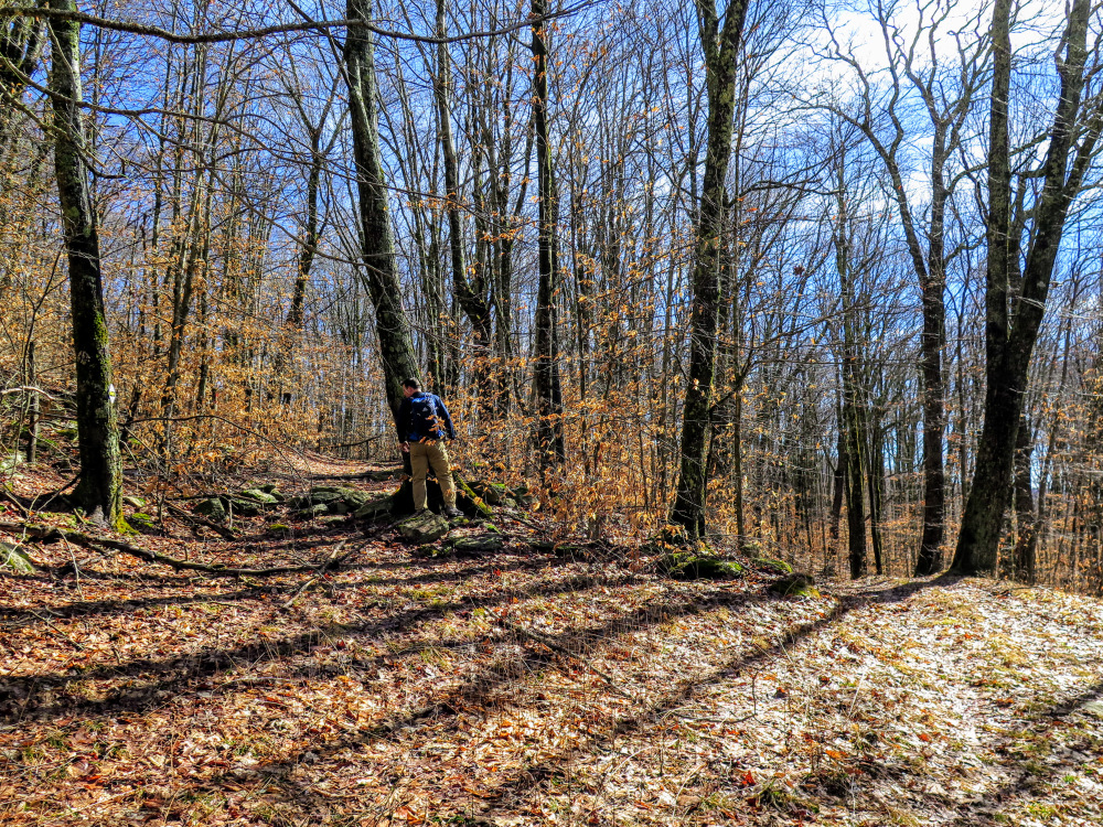
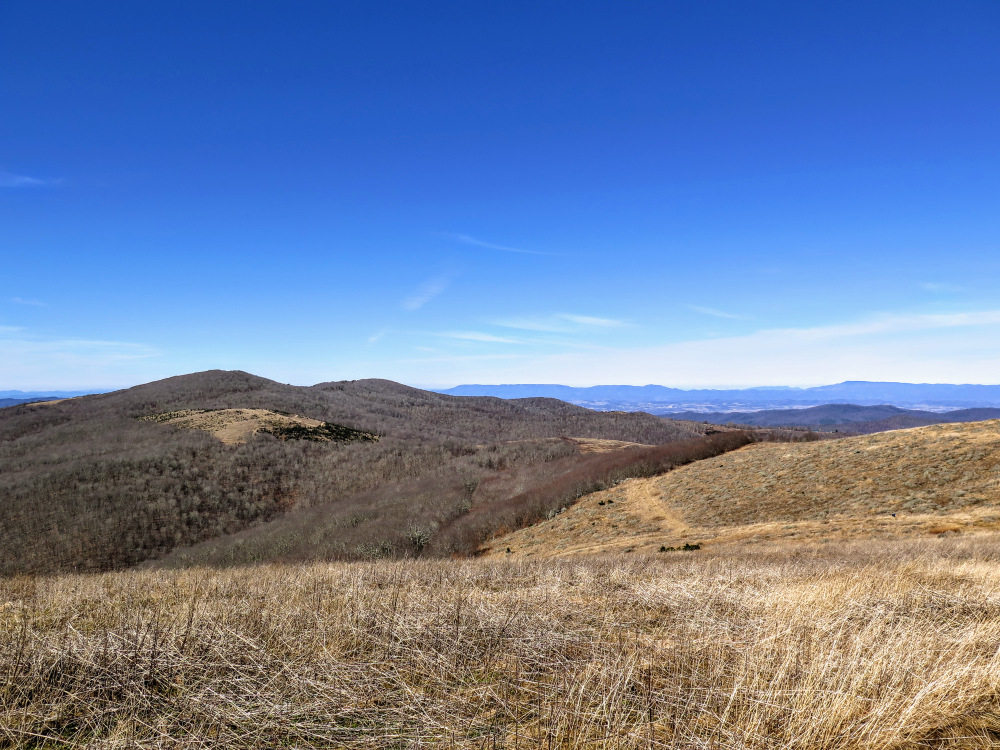
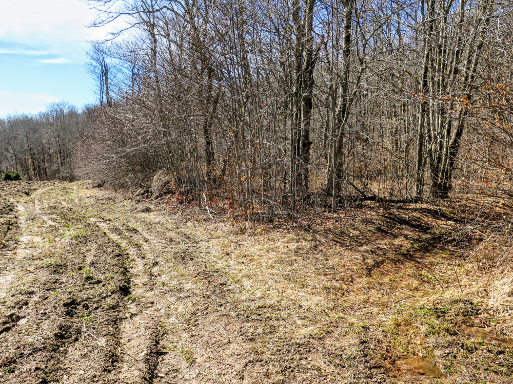
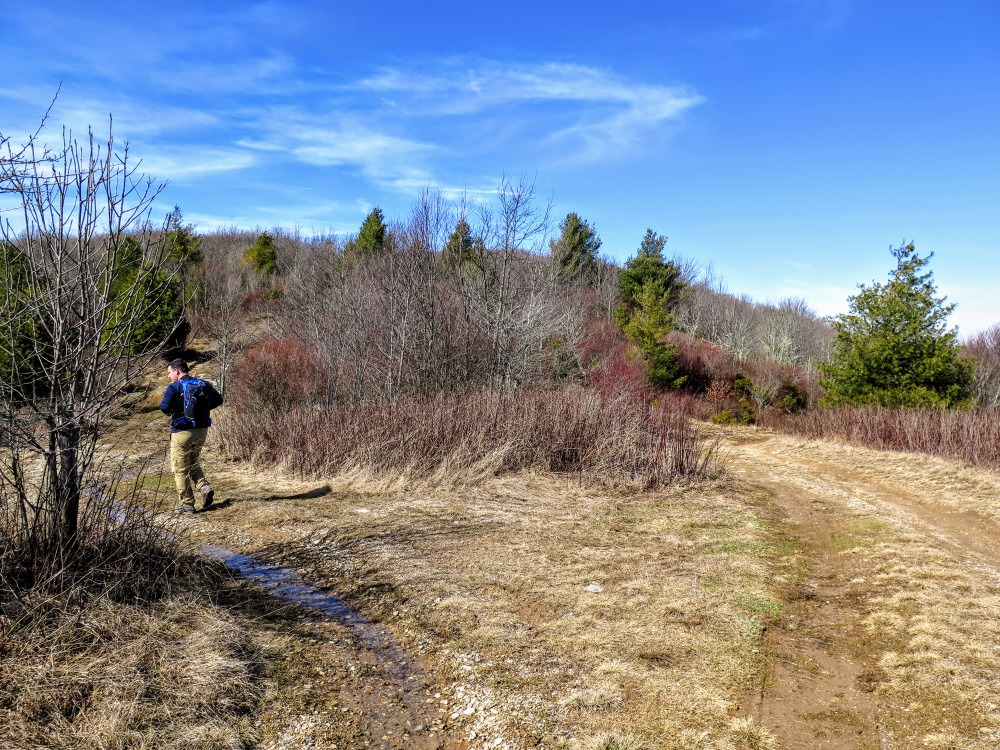
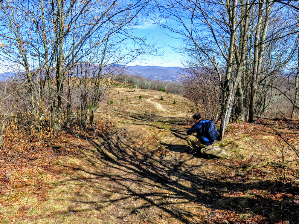
- Mile 0.0 – Parking is available at the Burnt School Cemetery entrance for the Pond Mountain Game Land. The trail begins on the left side of the parking area, following a forest road. Almost immediately the forest road leaves the cover of the trees and traverses open hillsides. The game land consists of former grazing and Christmas tree farm land.
- Mile 1.2 – T-junction with a forest road on the left below a small hill.
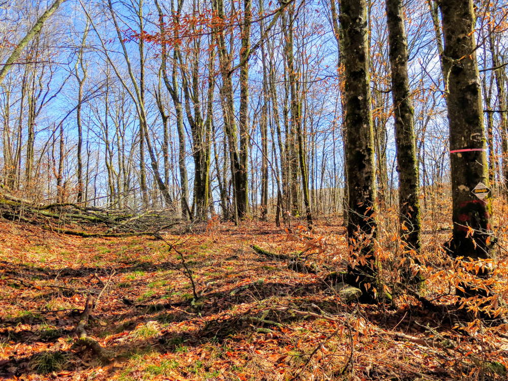
- Mile 1.9 – Cattle gate on the left side of the road. Private property signs and fencing are a prominent feature on the left side of the road beyond this intersection.
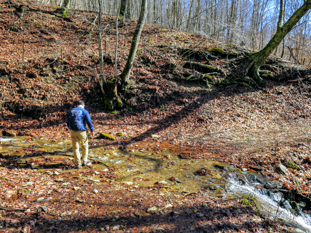
- Mile 2.0 – Rock hop a tributary in Denny Hollow.
- Mile 2.25 – Rock hop a second tributary in Denny Hollow.
- Mile 2.45 – Confusing Y-junction with a forest road on the left that is blocked by barbed wire. Turn left, carefully passing through the large spaces in the barbed wire. The private property remains on the left side of the road, and this barbed wire gate is a remnant that hasn’t been removed. It is likely that the forest road on the right is a long route around this shortcut eventually leading to the same trail junction at Mile 2.65, but this wasn’t explored.
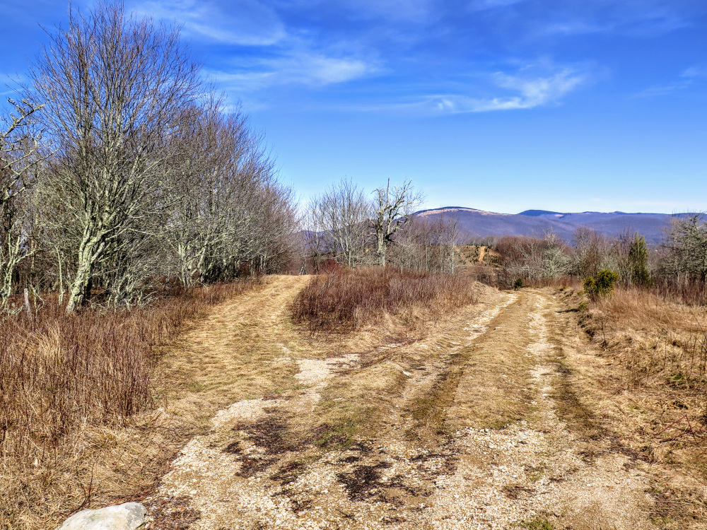
- Mile 2.65 – Y-junction with a forest road on the right. A tree at the junction has a North Carolina Wildlife Boundary sign.
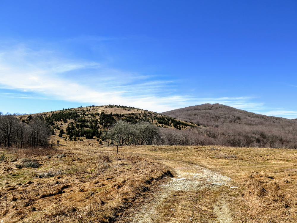
- Mile 2.7 – T-junction with an old forest road on the left leading around a knob and an abandoned tree farm.
- Mile 2.85 – Cross intersection with signed horse trails leading from Pond Mountain to the abandoned tree farm. Turn right heading east.
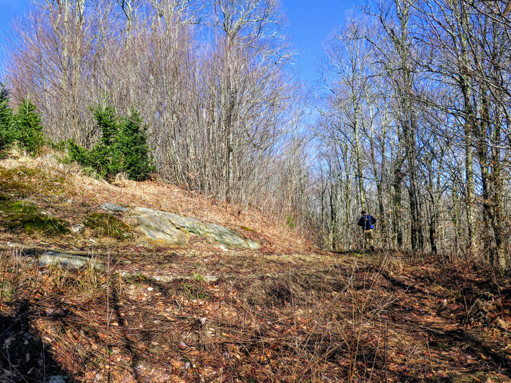
- Mile 3.15 – Y-junction with a forest road/horse trail on the left heading northeast. From here the trail briefly dives into trees before climbing Pond Mountain.
- Mile 3.6 – T-junction with a forest road on the right that bypasses the summit of Pond Mountain.
- Mile 3.8 – Turn right away from a property gate towards the summit of Pond Mountain, which is off of the road in the grasses above a barn.
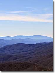
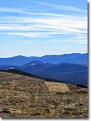
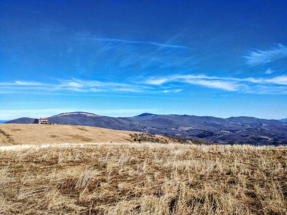
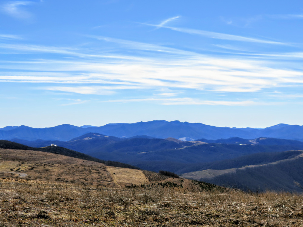
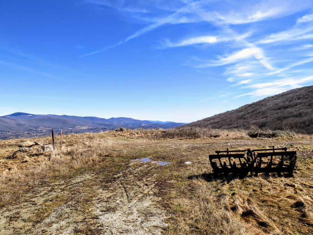
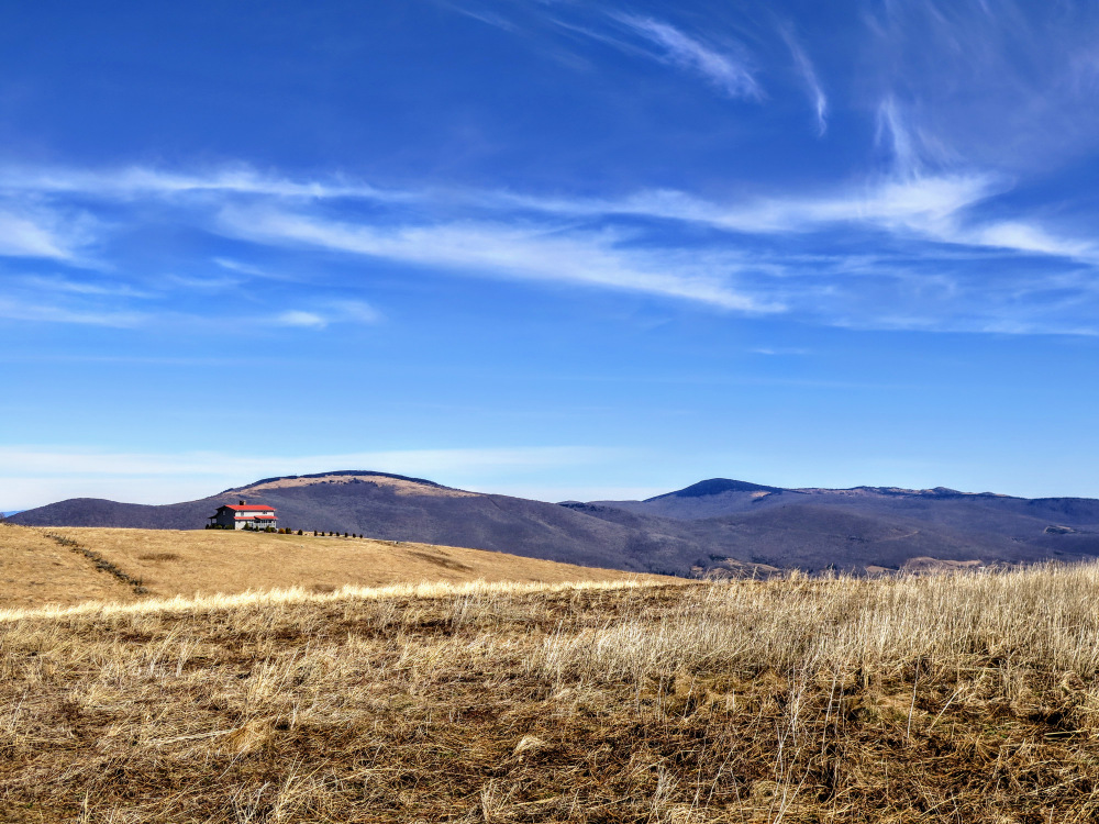
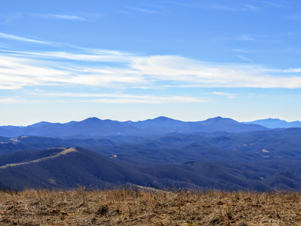
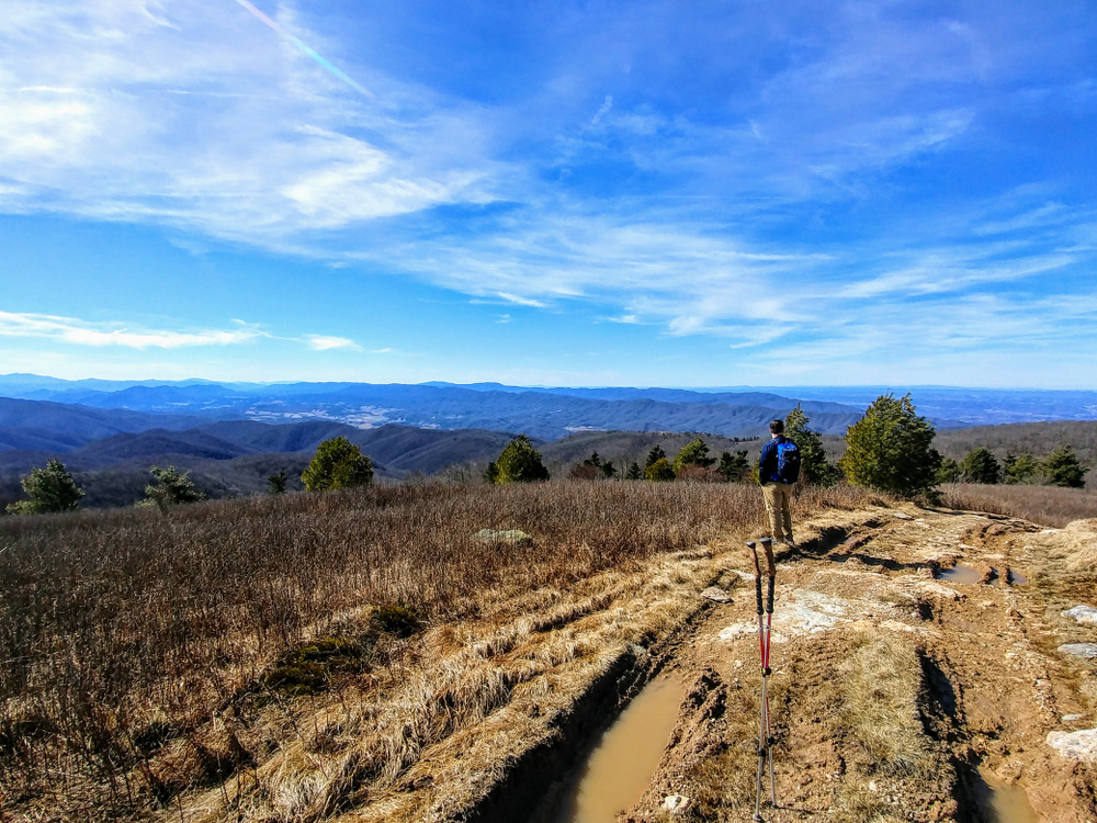
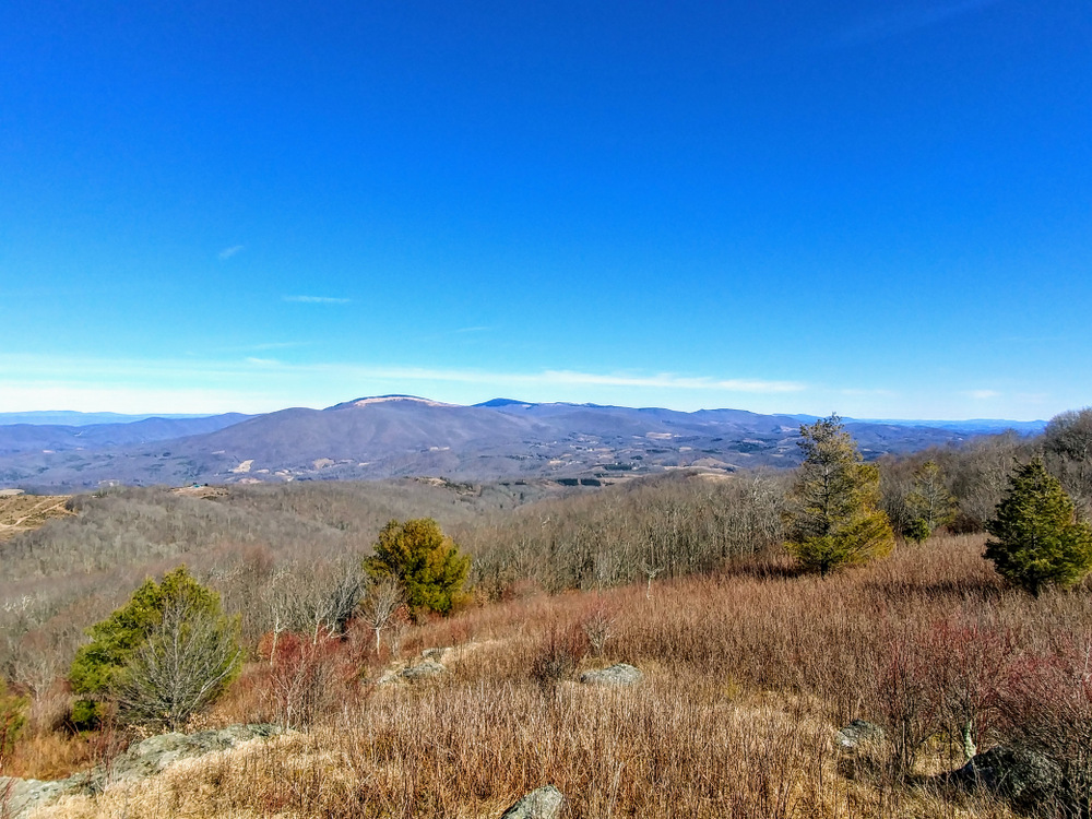
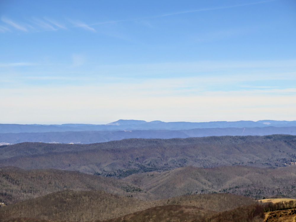
- Mile 4.0 – The summit of Pond Mountain (4,960 feet) offers spectacular 360° views of the Iron Mountains, Amphibolite Mountains, and Roan Highlands. Immediately to the northwest is Stone Mountain. Due north a house sits on top of the second summit of Pond Mountain. This house has a phenomenal view northeast of the tallest peaks in the Iron Mountains and Virginia, including Whitetop Mountain with a large bald swath below the summit, and the blackish-looking Mount Rogers. The balds of Pond Mountain continue southeast below the summit for quite a distance. The parking lot for the game land access is only a few hundred yards from the summit. Just beyond the balds are Phoenix Mountain and Mount Jefferson, the northernmost peaks of the Amphibolite Mountains. The craggy Three Top Mountain is to the right of Mount Jefferson, and the tallest peaks in the Amphibolite Mountains are south-southeast. From left to right, the most prominent summits are The Peak, Elk Knob, and Snake Mountain. In the distant south is Grandfather Mountain and the ski mountains around Boone, NC. The Roan Highlands are located south-southwest, to the right of Beech Mountain. On a crystal clear day you may be able to see Big Bald and other tall peaks of the Bald Mountains over 50 miles away. Turn around and head back down the mountain.
- Mile 5.0 – On the right side of the trail is a tiny pond that may be dry. The hillside above the pond provides unobstructed views of the Mount Rogers area.
- Mile 5.3 – Continue right onto the forest road that bypasses the old Christmas tree farm on the knob.
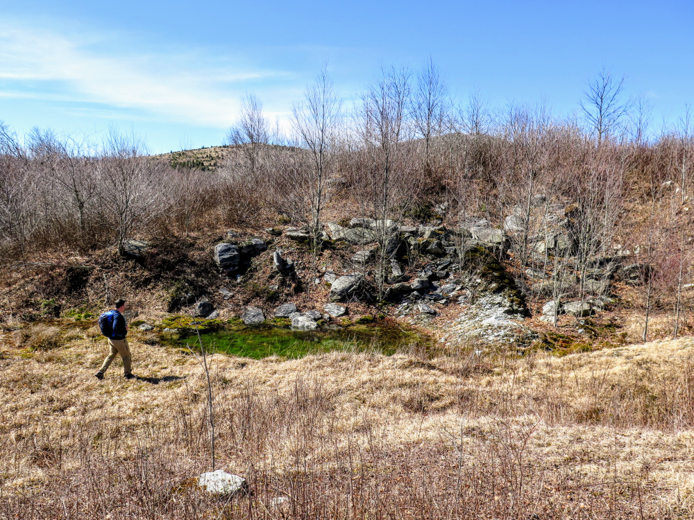
- Mile 5.6 – Below the trail on the right is a small dam and pond through the trees.
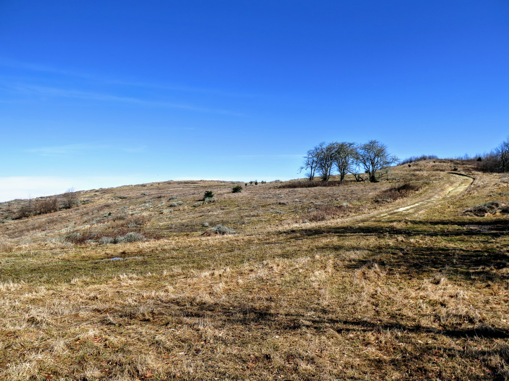
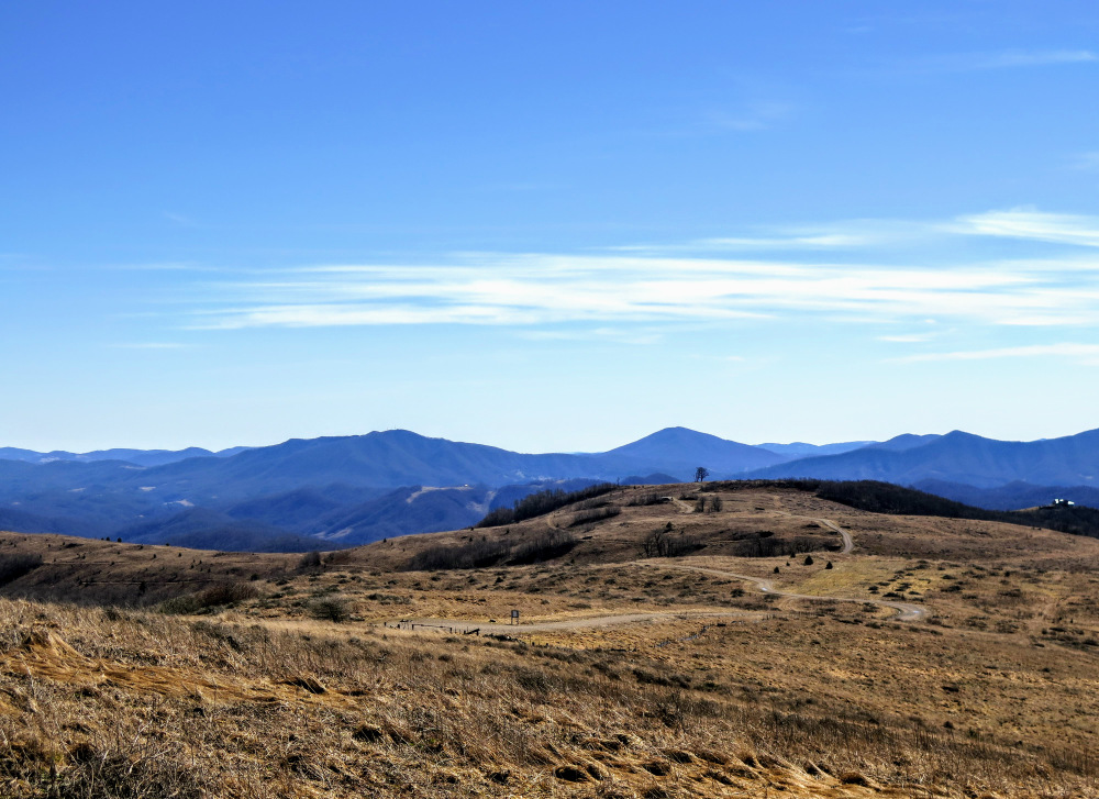
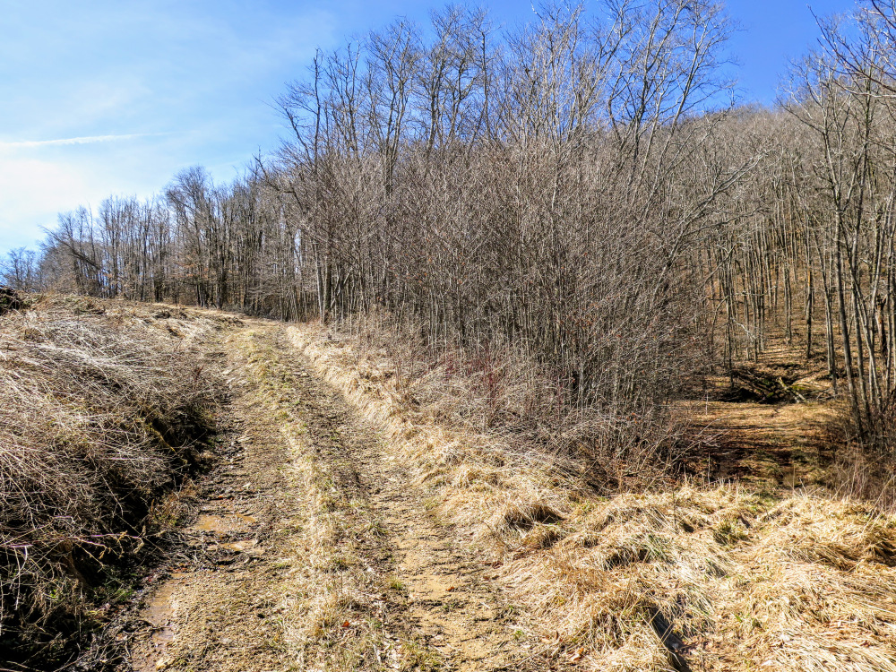
- Mile 5.7 – Four-way junction in a wide, flat field. A faint path leads to the left directly across the knob and the forest road continues straight around the south side of the knob. Game land backcountry camping is possible on the west side of the trail in the forest. Look for the second right turn, following a forest road into the trees that crosses a muddy spring and then switchbacks uphill. Soon the trail climbs steeply towards the summit of Stone Mountain.
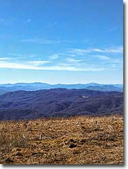
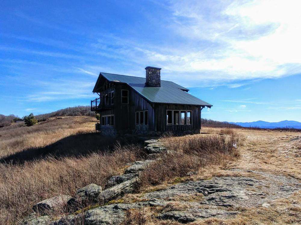
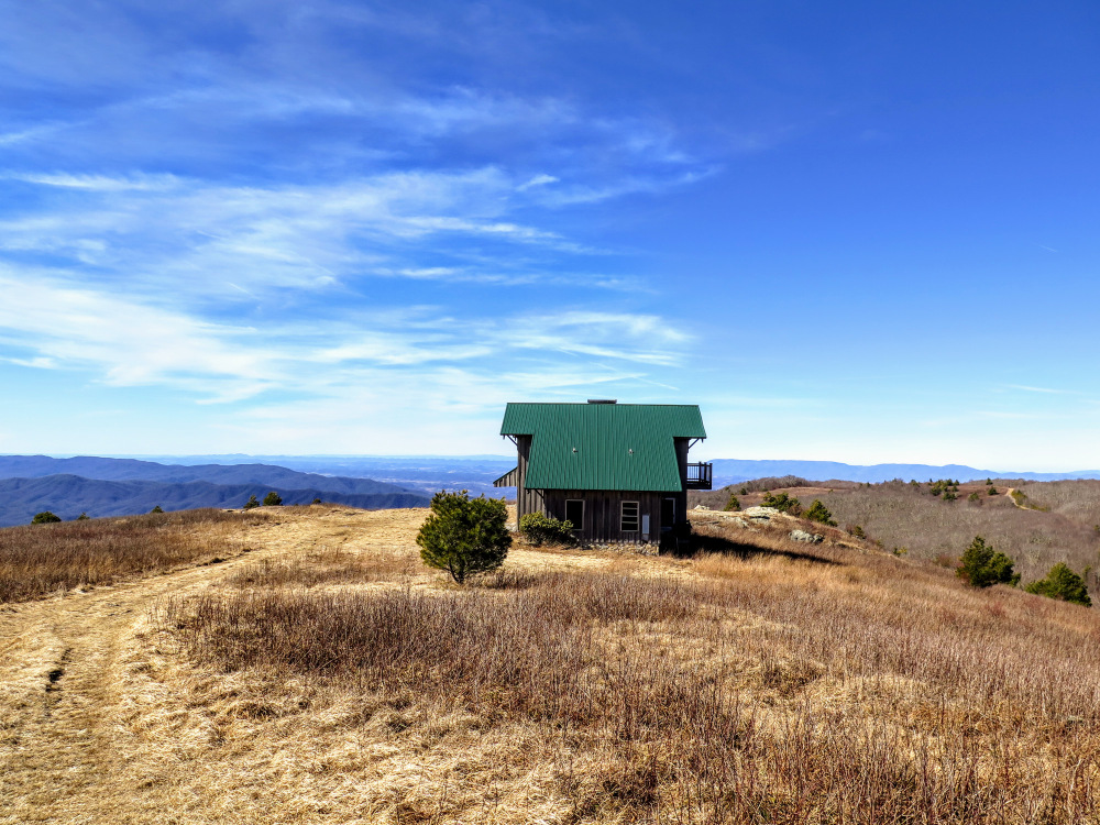
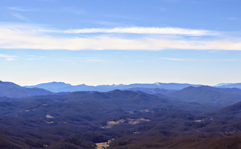
- Mile 6.1 – The road crosses the summit of Stone Mountain (4,980 feet) and continues to an abandoned house with sweeping views south, west, and north. The dominant peak in the distant north is Beartown Mountain. You have views northeast of the Mount Rogers area akin to the rest of the hike. To reach the tri-state corner, continue north on the forest road.
- Mile 6.5 – Y-junction with a forest road on the left that connects to the Rogers Ridge Horse Trail in Tennessee.
- Mile 6.8 – At a Y-split stay left and soon you will reach the tri-state corner of North Carolina, Tennessee, and Virginia. This is the highest elevation tri-state corner in the eastern U.S at 4,628 feet and the 10th highest in the U.S. The forest road continues north towards a tree farm. Turn around and head back to Stone Mountain.
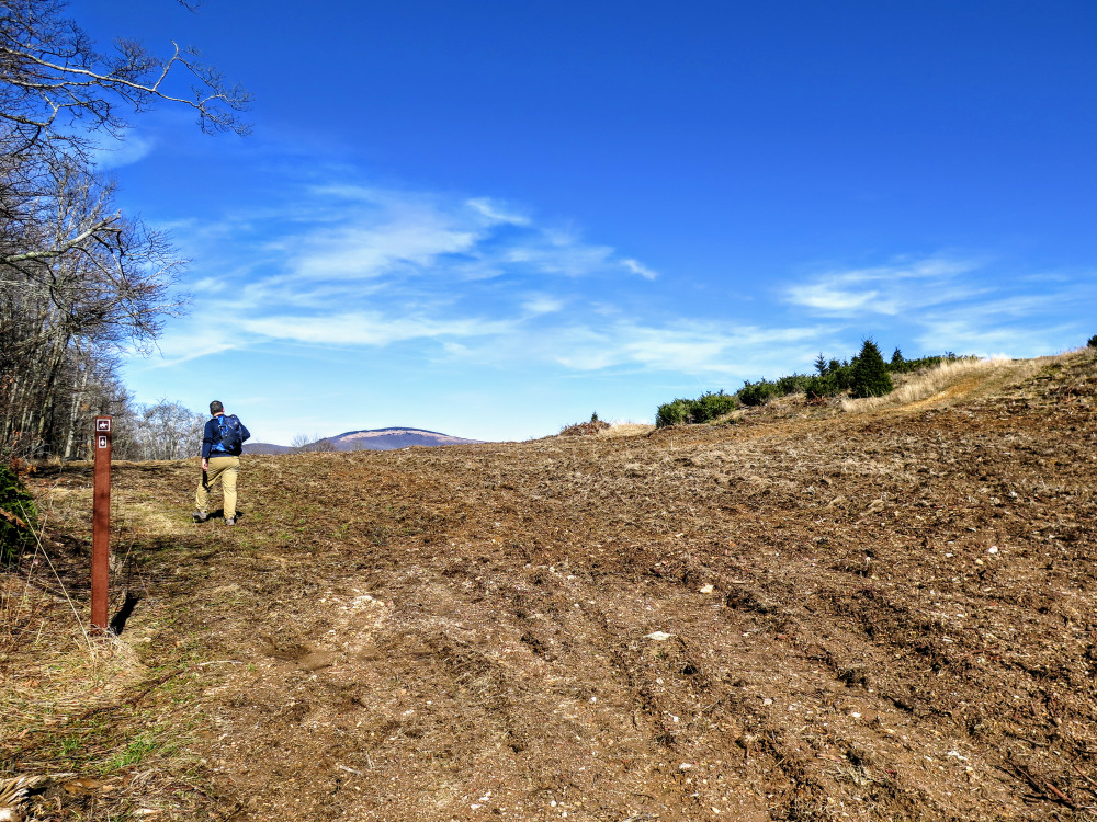
- Mile 7.8 – Follow the faint path over the top of the old Christmas tree farm. You can also use either forest road to bypass the knob, but you’ll miss out on the views from the top.
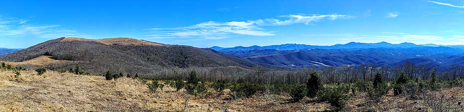
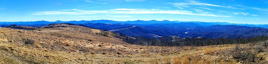
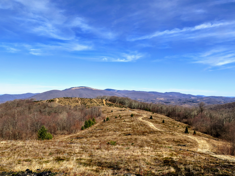
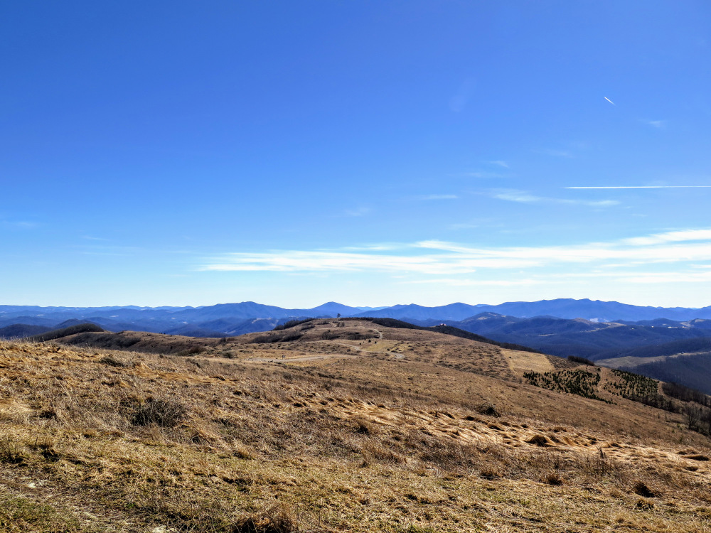
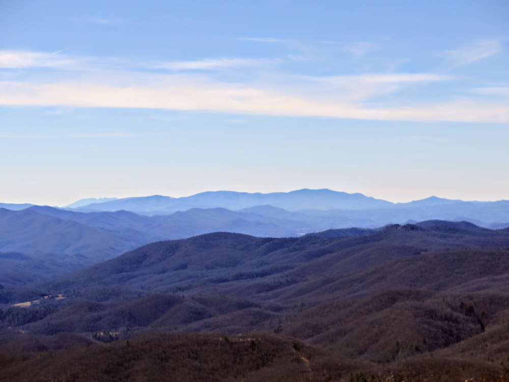
- Mile 8.0 – Cross the high point of the knob amidst remaining Christmas trees. From here you’ll have 360° views sandwiched between Pond Mountain and Stone Mountain. This is arguably the best view of the twin summits of Pond Mountain due east.
- Mile 8.2 – Turn right on the main forest road heading south.
- Mile 10.7 – Hike ends at the Burnt School Cemetery parking lot.
|

